Route Stats and Prologue:
Mountains: Challenger Point (14,086’)
Route: Standard route variation meeting the W ridge at 13900’. Started from Pine Cone Way gate in the town of Crestone.
Stats:
Elevation Gain – 5634’ (Garmin Fenix)
Roundtrip Mileage – 15.72 miles
Crew: Jamie and Prakash
Time: 15:45 (9.5 hours to summit and 6:15 to descend)
After a successful bid on Missouri the prior Friday I wanted to attempt one more winter 14er summit before we were through with the break. I did a HR zone 3 interval hike with a 30lb+ pack on Bear Peak for muscular endurance the day after Xmas and did well, and that gave me some confidence. Just then Jamie texted with his plans for the Crestones. I didn’t want to sign up for an objective like that without at least two or three technically easier peaks first, to prime the cardiovascular engine. I suggested attempting Challenger and Jamie accepted. He and I had each attempted Challenger Point twice before. In both my solo attempts last winter I’d broken trail in fresh snow to willow lake and given up after getting exhausted. I had not done much in terms of muscular endurance for hiking leading up to the last winter. My training was more focused on BC skiing ME which did not bode well for trail-breaking through deep snow with snowshoes. I’ve also tended to lose motivation on these solo trips lately, tending to think about family, and I think that contributed to the failures as well. I was therefore grateful to have company. After some back and forth we decided to share an AirBnB the night before and daytrip the peak.
Although I much prefer skis on these peaks the slow start to winter and tight switchbacks on the willow lake approach suggested that snowshoes would make more sense. We decided to bring avy gear, crampons and an axe based on some loaded gullies to cross, and reports I’d read that snow on that North Face tended to be hardpacked earlier in the season. We also brought microspikes in case the approach was bootpacked and icy.
We drove to the end of Pinecone way early to get geared up and we got started at 4:30AM. It was 13F out, 6 degrees higher than the prior Friday which seemed promising –

The Approach and Booter up to the Ridge:
Right off the bat we had great luck in the form of a bootpacked approach and we made good time, reaching the top of the headwall below willow lake at 7:10AM. There are some excellent waterfall climbs in that area that may warrant a dedicated trip at a different time.

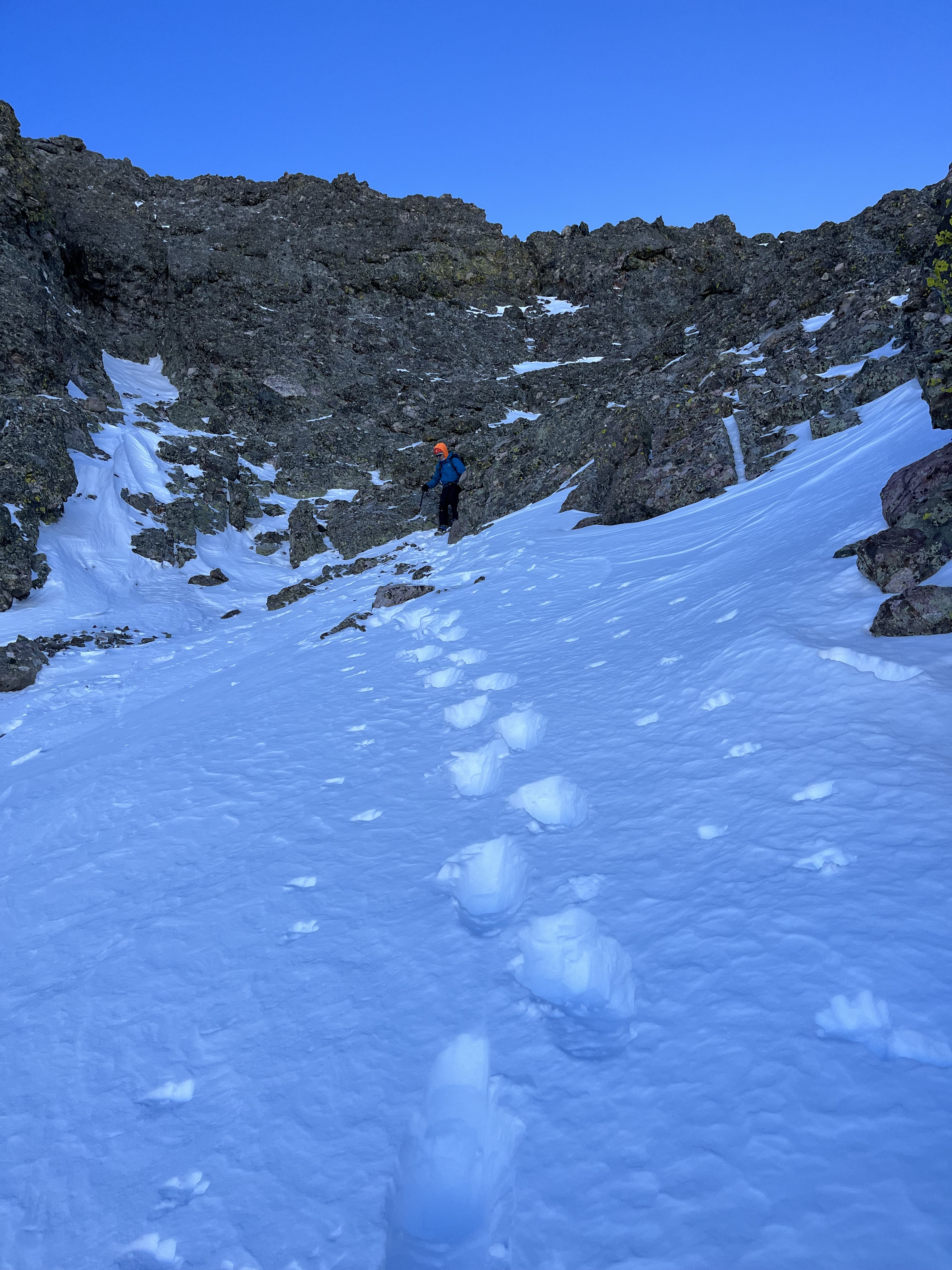
A snowshoe trail continued briefly in the woods above the headwall. We donned our clown feet and broke trail through mid-shin deep snow, with occasionally deeper postholing, reaching the lake at 8:35AM.

We stopped there for a second snack of the morning and some tea before I began breaking trail above and around the lake to take us to the base of the climb.


We then began discussing our route up the face.

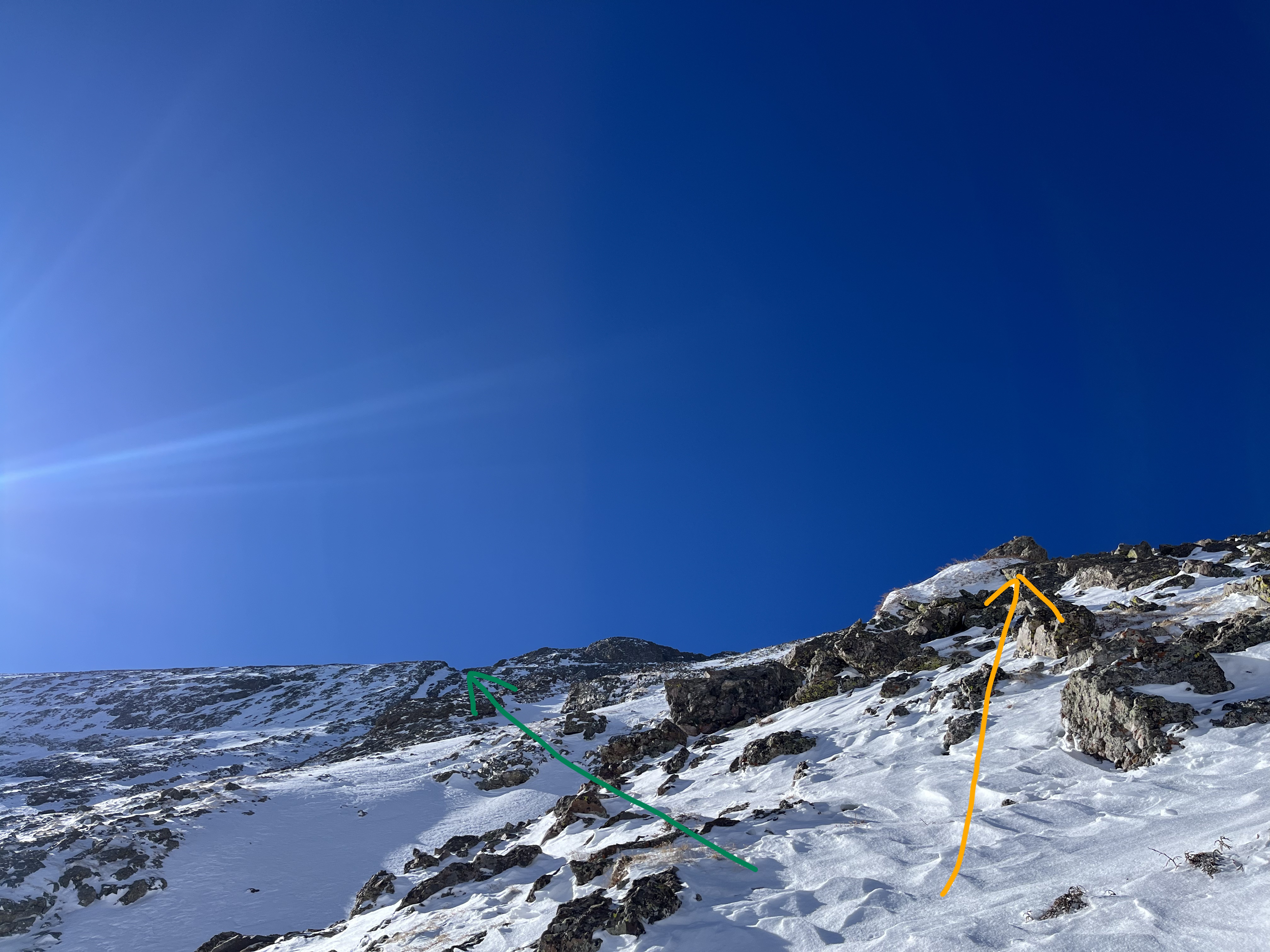
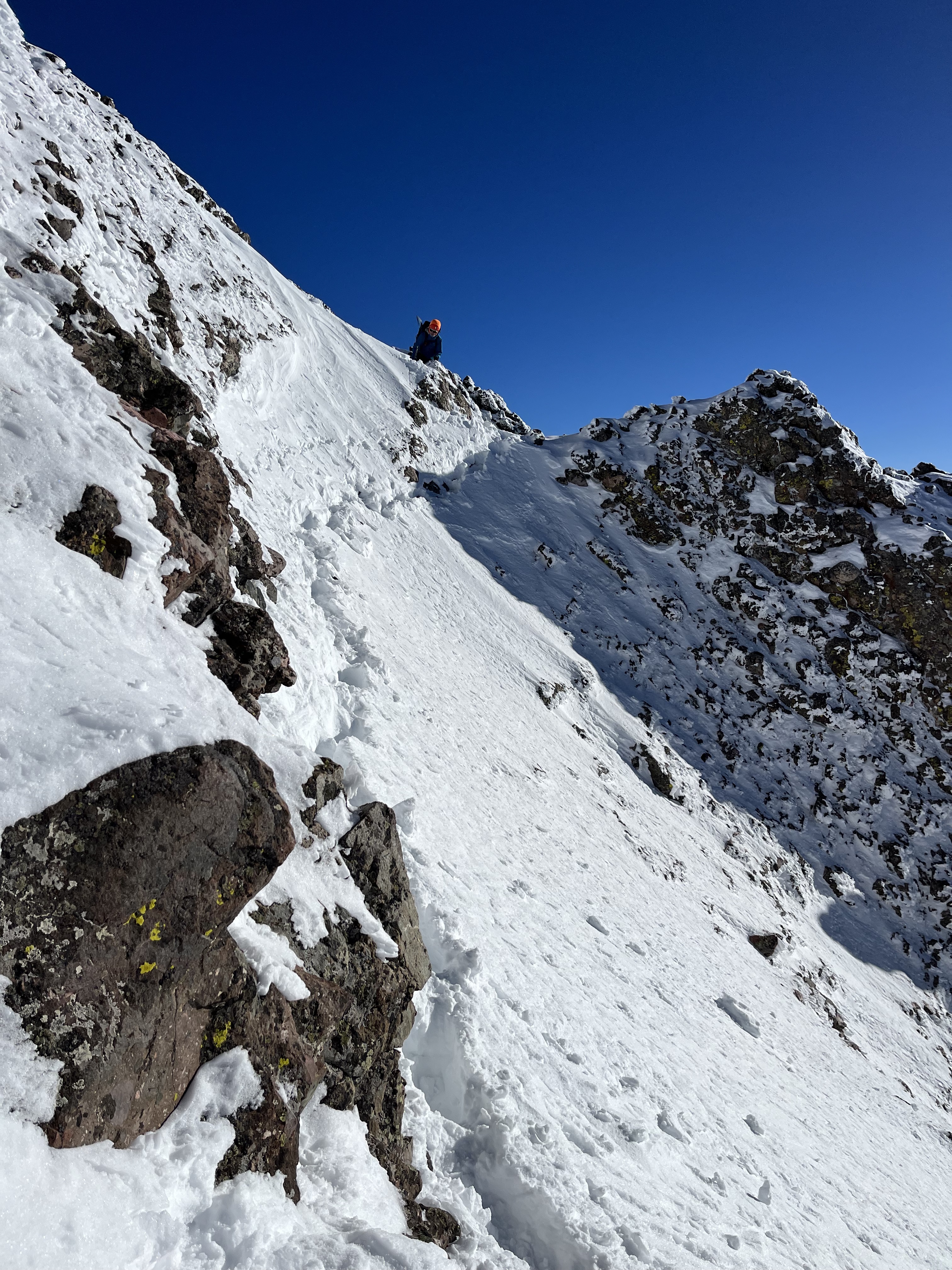
We saw a few different options to gain the ridge. The last time I’d climbed Challenger point was 16 years ago and I didn’t recall the details of the ridge. I’d read a prior report that discussed beelining towards a notch on the ridge but had not digested why they’d done that. Jamie and I instead picked a rib that avoided some cross-loaded gullies and followed lower angled rock-anchored paths. Comparison to the standard route (left) shows that our rib would put us on the ridge at around 13800’, much further west of the notch –

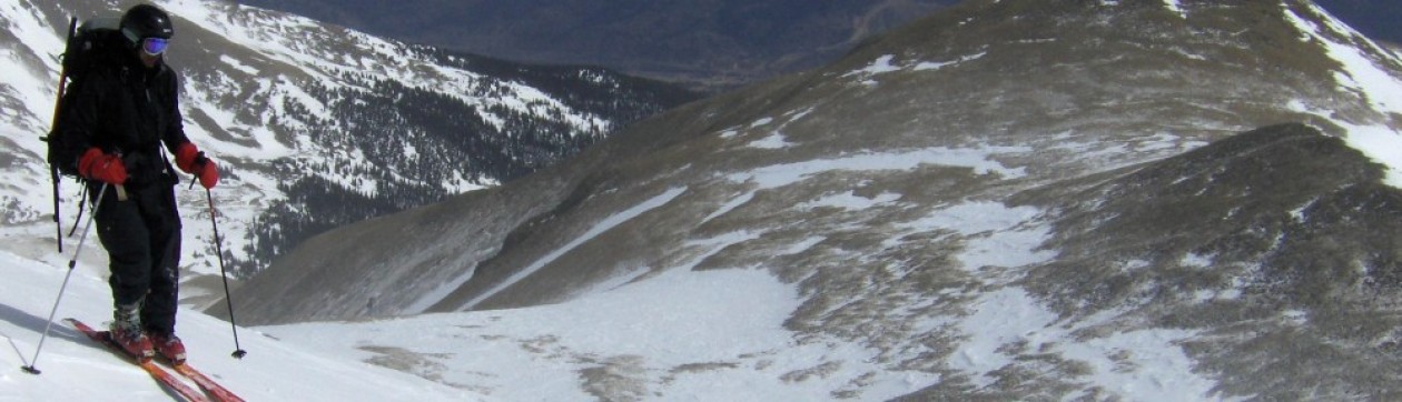
We turned beacons on and threaded a few gullies one at a time en-route to a spot below the face where we could stash snowshoes –
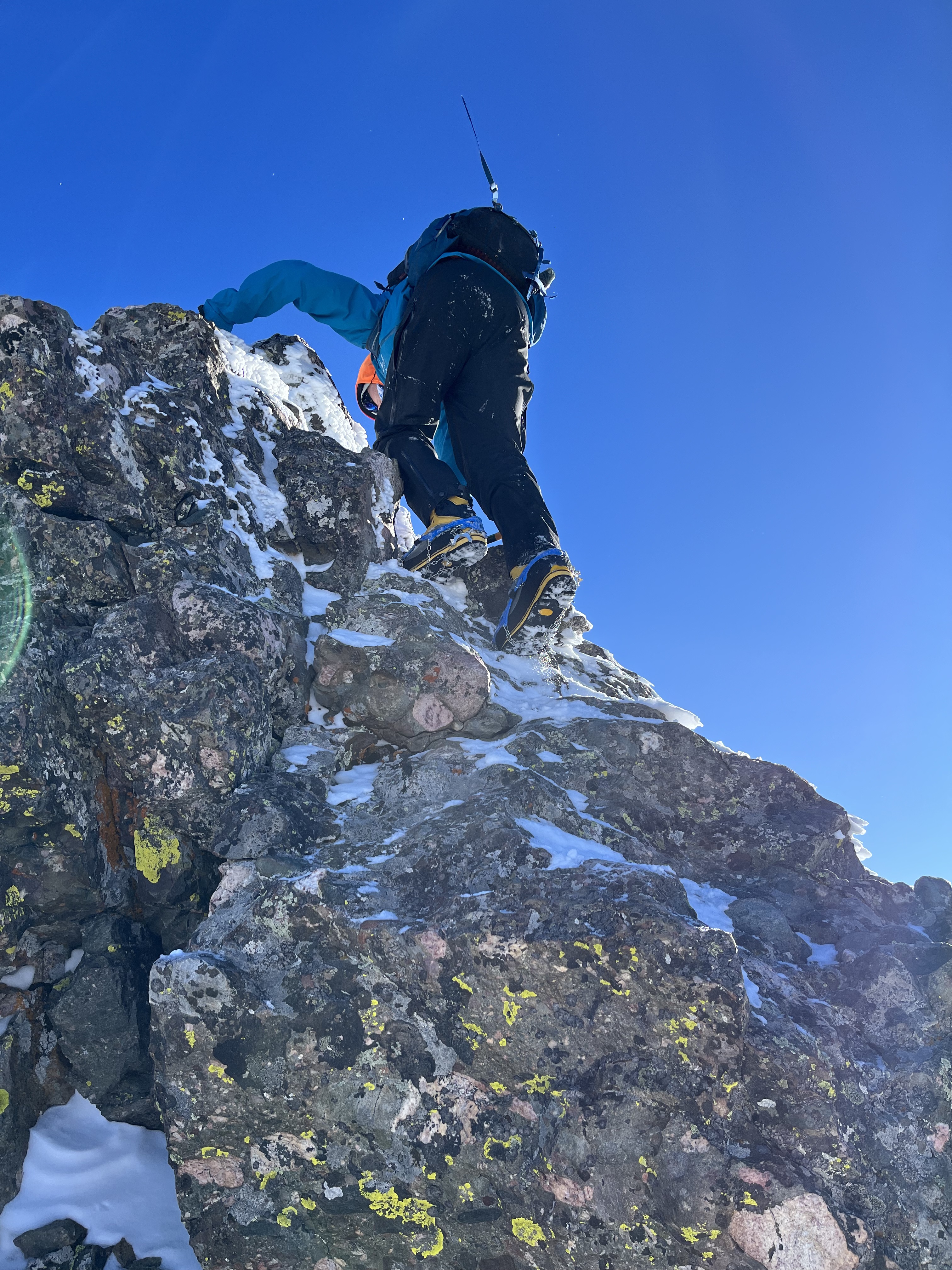
We stashed snowshoes at approx. 12300’, had a leisurely snack/tea, put microspikes / helmets on and began heading up the rib a little after 10:30AM. I left one pole with the snowshoes and decided to pull out my axe instead. I decided to bring my Petzl Sum-tec along on only its second field test after a Liberty Ridge (Rainier) attempt. This picture is looking up at the notch (green) we should probably have headed towards instead of the line (orange) we took –
The waterfall above willow lake

… and Mt. Adams behind Jamie –

The Ridge and Summit:
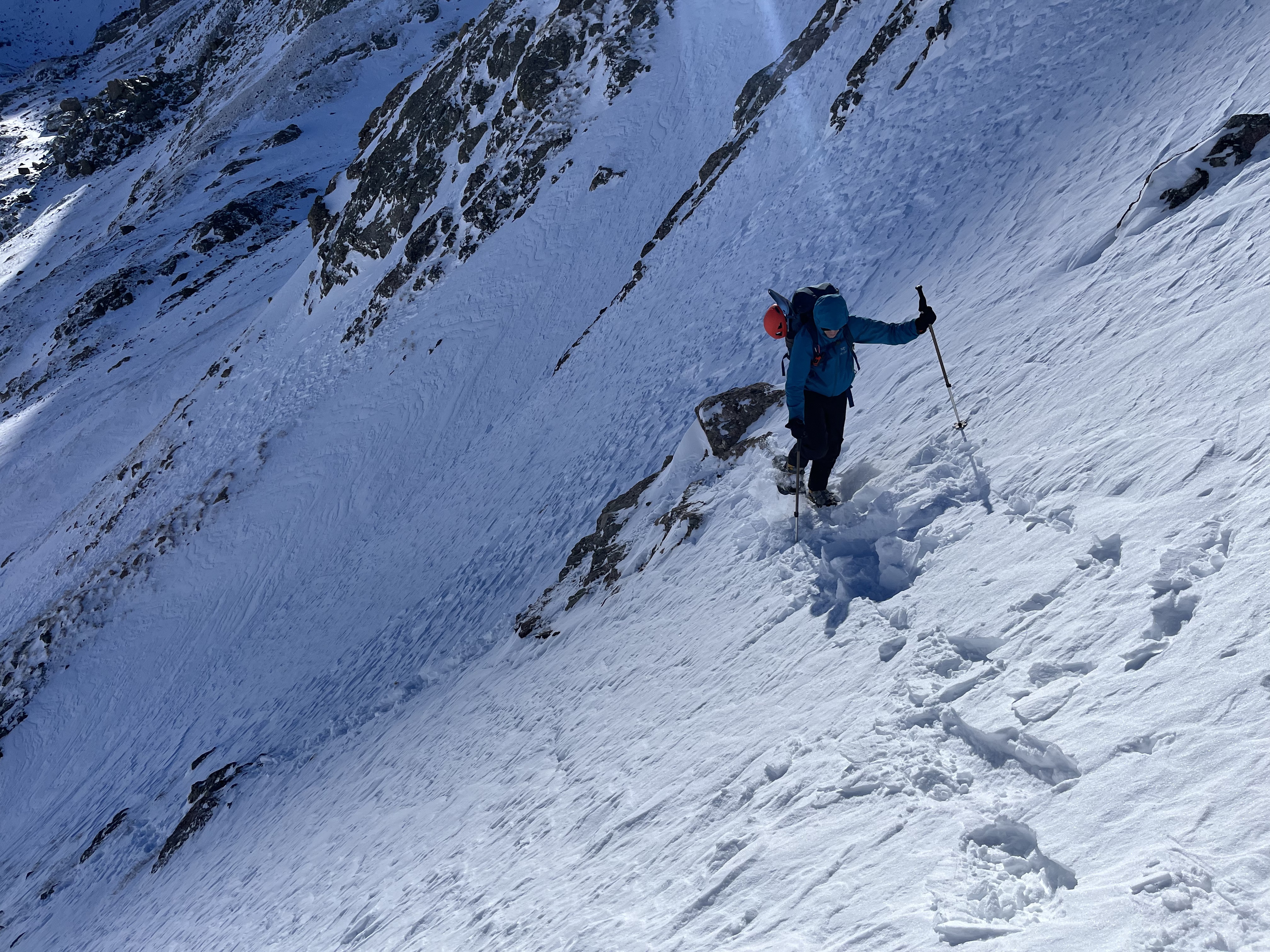
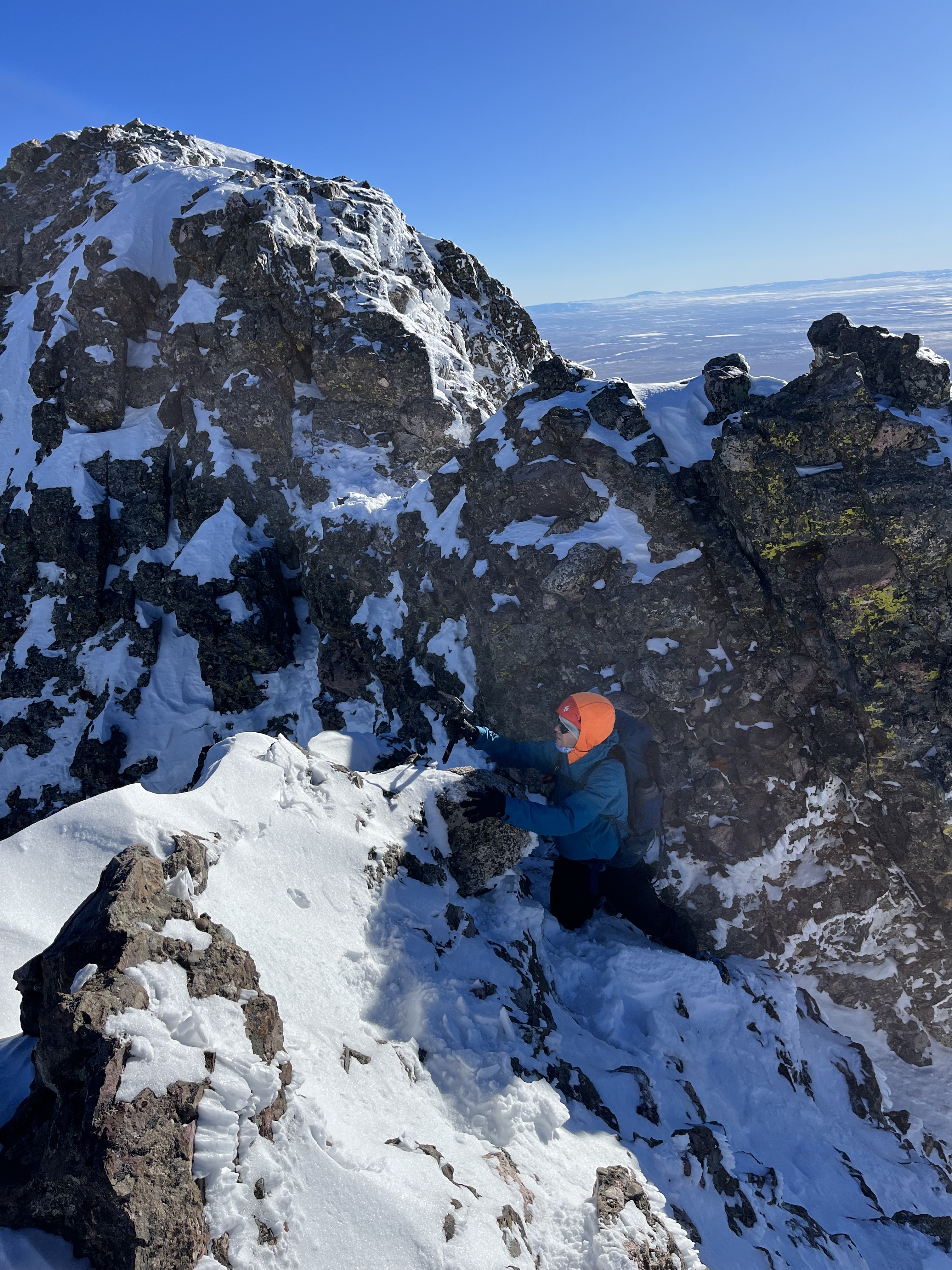
When we finally topped out at the ridge at around 12:15PM I realized that not beelining for the notch may have added about an hour or more to our roundtrip time since there appeared at least 3 points on the ridge that needed to be traversed around either on the north or south sides. I started off with one traverse on the north side on top of one of the gullies on the North face –
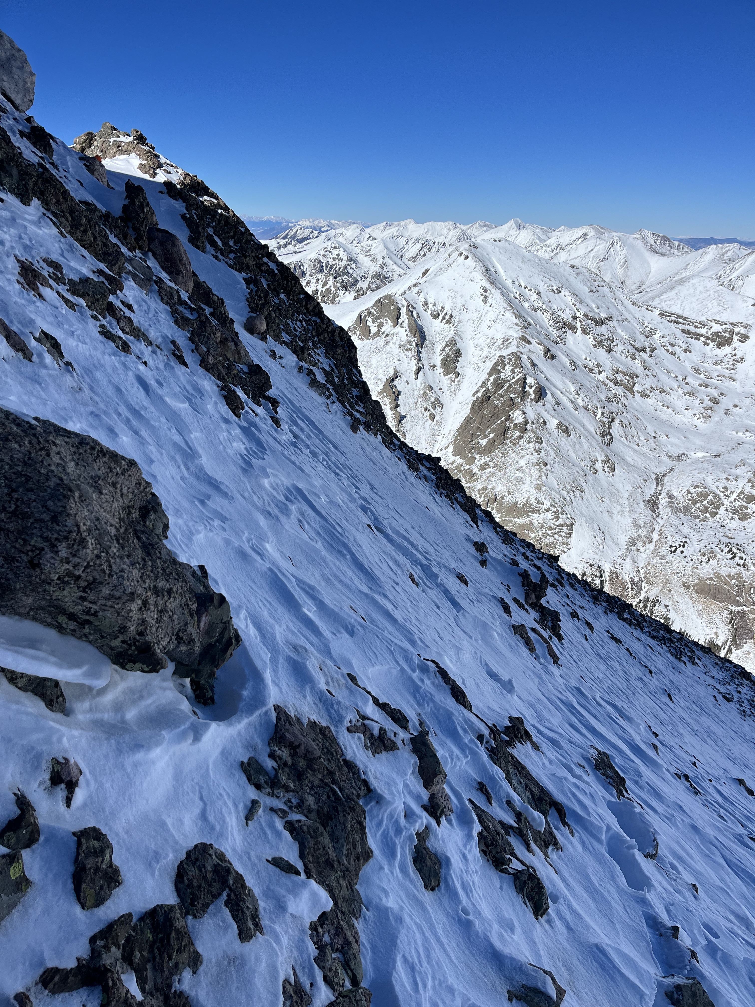
Followed by a quick scramble back up to the ridge crest –


At the top of the ridge crest, we found this seemingly easy snowy spine that unfortunately ended with a drop off that I couldn’t see, so I decided to traverse snow on the South side of the crest. There were some very cool rime formations plastering all the rock on that south side of the ridge –

Beyond this traverse a couple more easy ridge crest scrambles were encountered, some requiring axe placements for mixed holds. The rime shattered, sounding like glass beads when I cleared them away for axe placements. These scrambles put us on easy class 2 terrain to the summit.
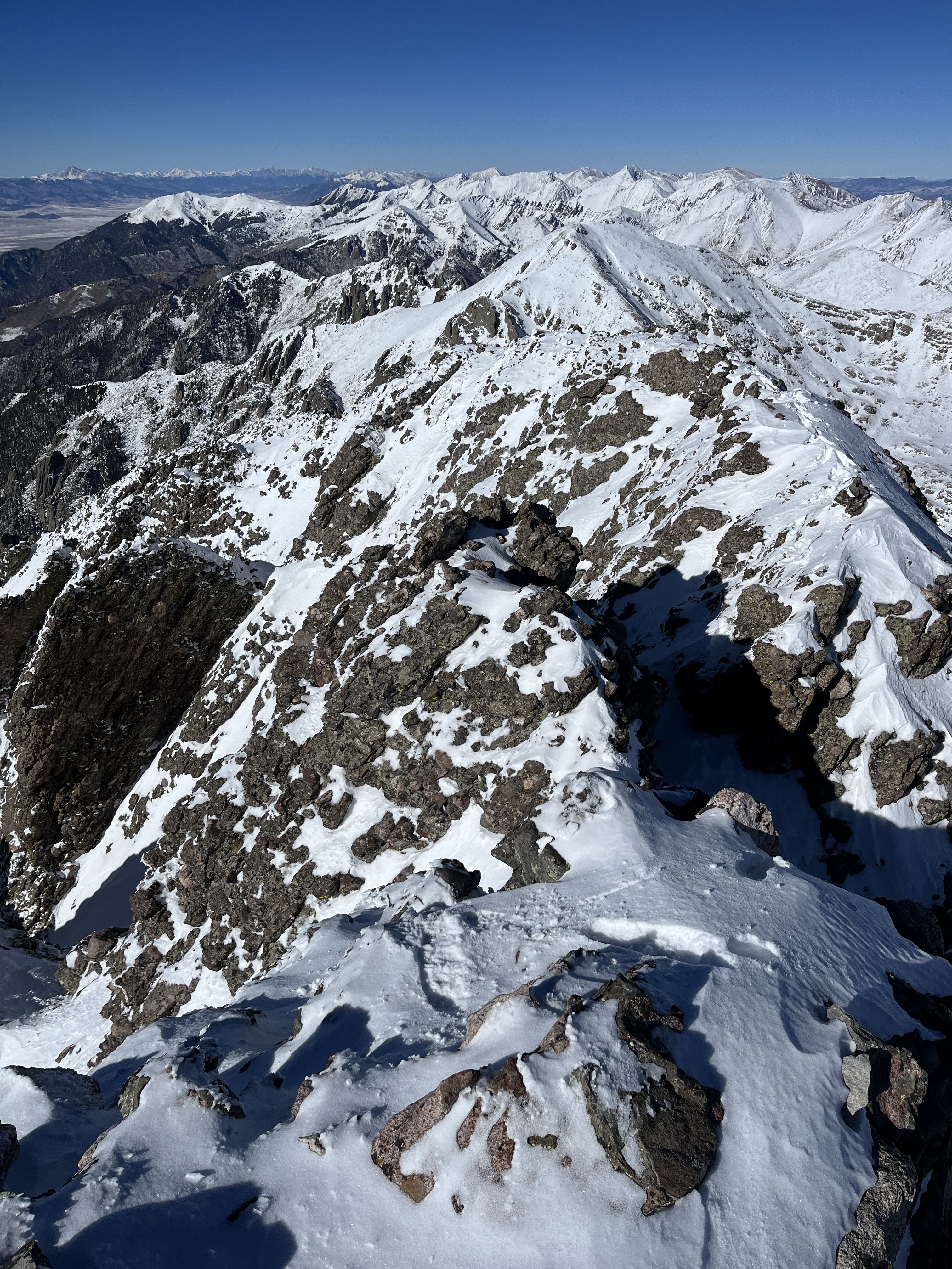

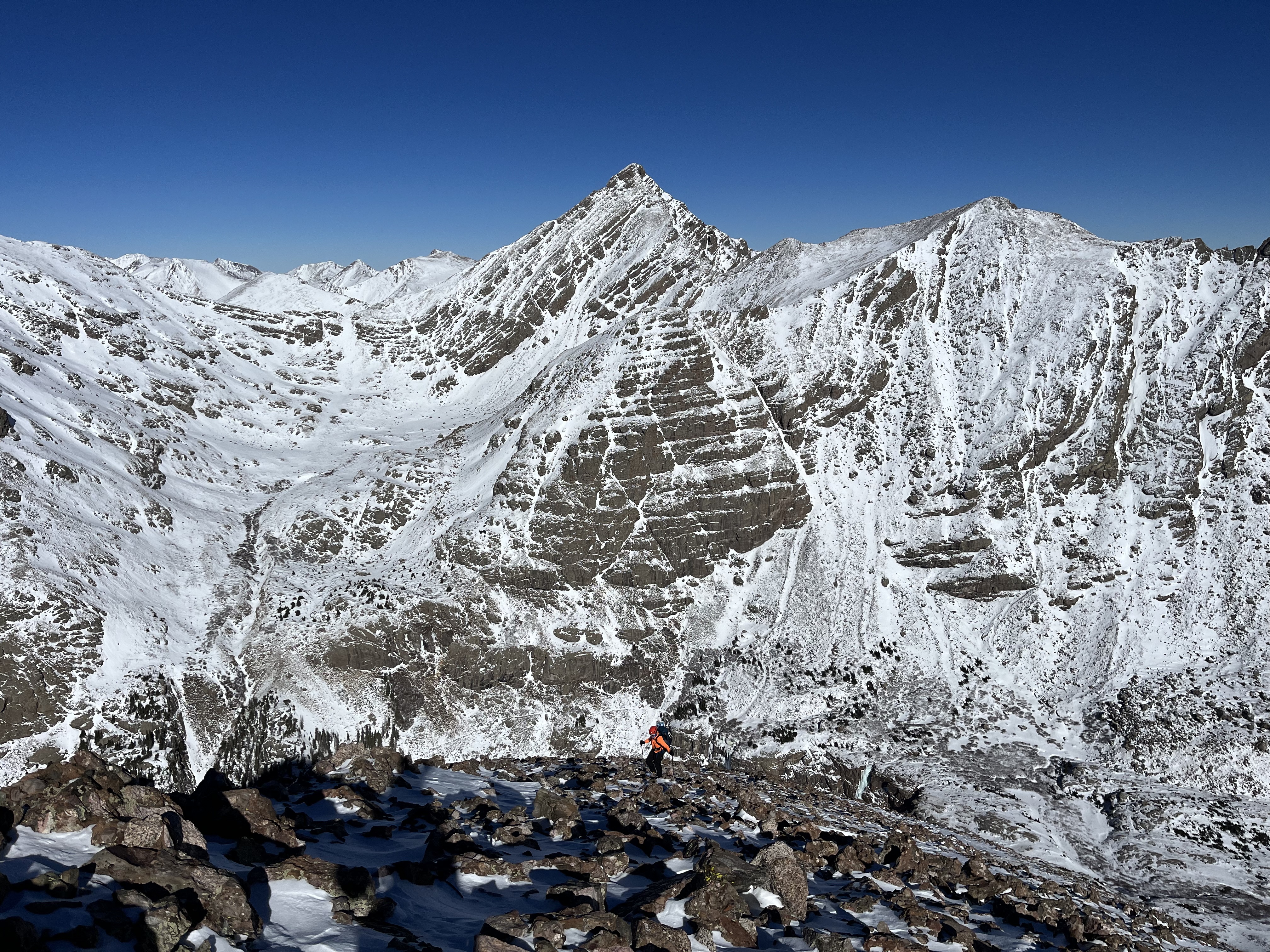
I arrived on summit at about 1:45PM. Kit Carson and the Needle, two of my remaining Sangres peaks were being their usual menacing selves –
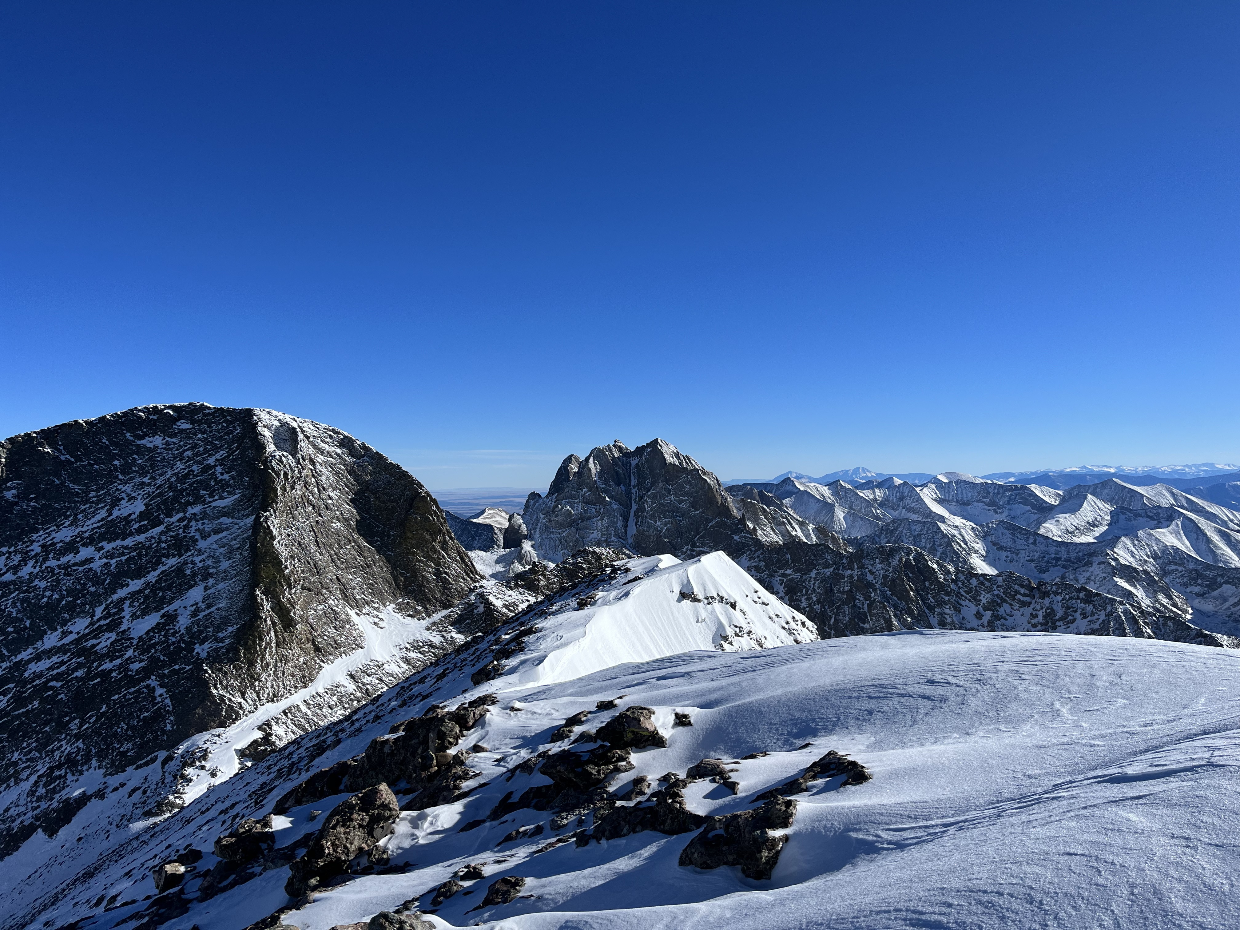
Jamie arrived at around 2PM and we ate some more food and took some pictures –

The Descent:
I contemplated taking the standard route back to the snowshoes but Jamie had left his poles at the start of the difficulties on the ridge so that committed us to downclimbing our ascent route. This made me anxious to start moving down quickly. Jamie was suffering some altitude sickness symptoms on the summit ridge, so I helped spot him on a few of the tricky downclimbs and traverses on the ridge –

Once past the difficulties of the ridge, we picked up Jamie’s poles and by passed one last scrambling section to traverse to the rib –

In retrospect I’m glad we followed the route we did because it added a lot of fun climbing to an otherwise straightforward route. When we got back below the ridge I sent Divya a text telling her we were past the trickiest parts of the climb, and that we would be back at the car by 8PM. We then began descending the rib and were back to the snowshoe stash at 4:20PM. I finished the rest of my tea, gave Jamie my last gel shot, and we started moving down towards the lake.
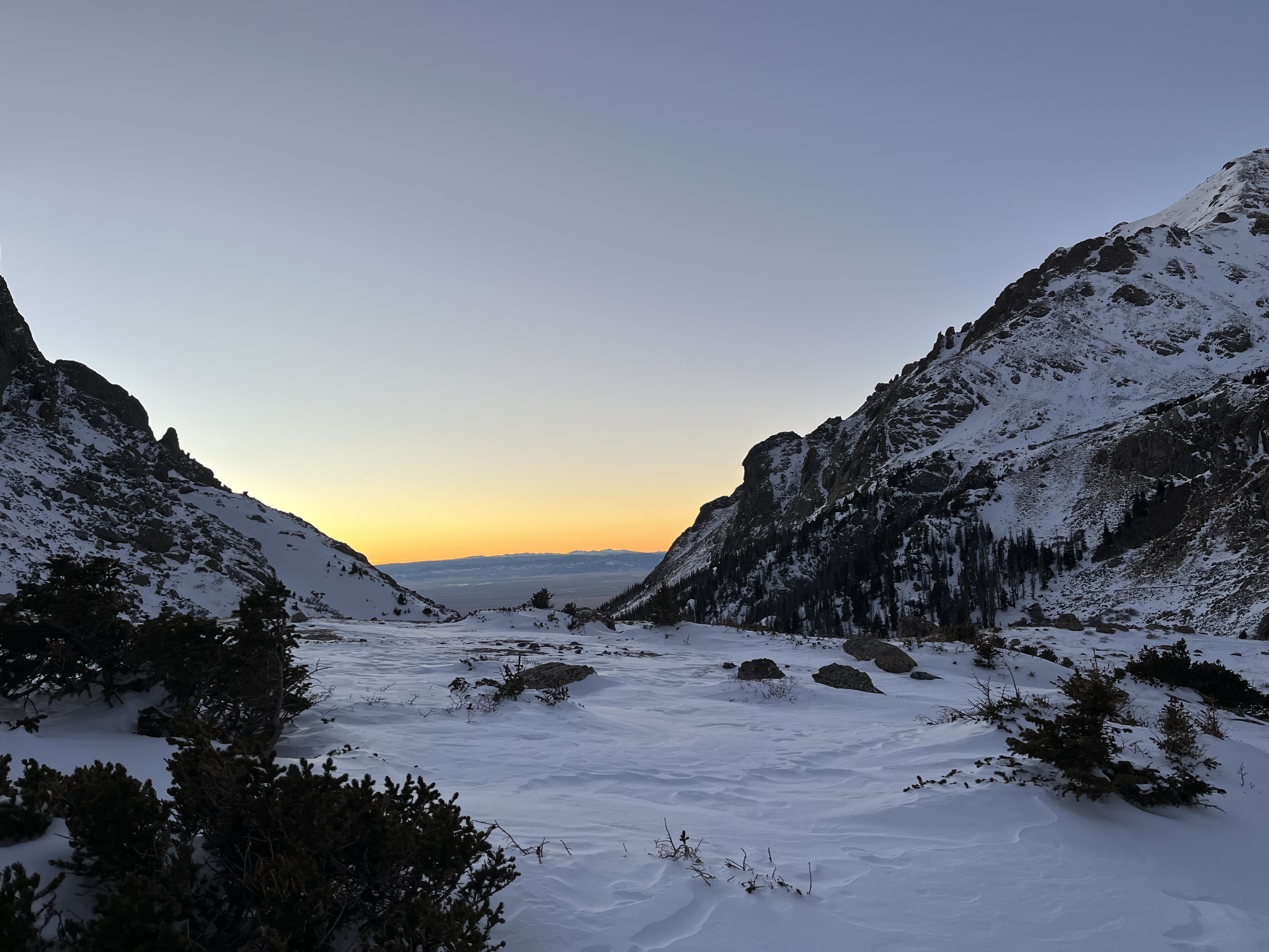
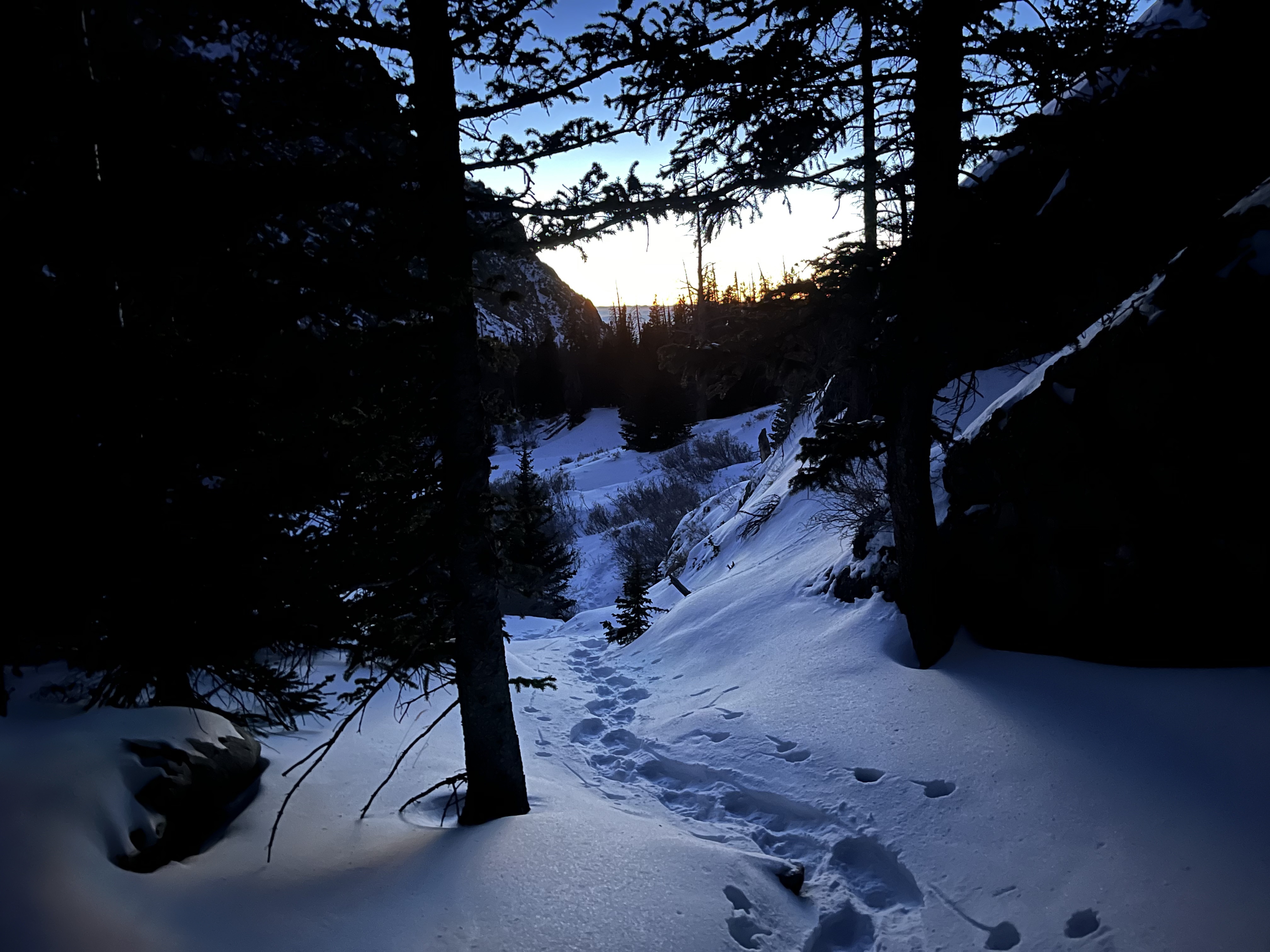
As we snowshoed through the woods the twilight scenery compelled me to stop and take breath.
Jamie was now starting to recover from his altitude sickness although his pace was slower. I traveled with him until we got to the easiest sections of the trail and then ran back to the car so I could text Divya by the 8PM cut off time. Jamie arrived out at around 8:30PM. We were both glad to not have to come back to this peak a fourth time.
Gear notes from the trip:
- Replace flask insulating sleeve,
- Mitten inners need more duct tape,
- Showa Temres gloves although widely touted as a great ice climbing glove did not really provide me the warmth I wanted. Might be worth trying out on some techie ice climbs this season. They may be ok for quick pitches in a lead-swinging scenario before returning to hand-warmer loaded mittens for belays.
- Petzl Sum-tec is perfect for low tech trips like this one. Need to purchase tip protectors for it and the whippet.
- OR pack is slowly starting to grow on me. It’s million tiny buckles and straps are annoying in that they cannot be operated reliably with mittens on in the winter. That said it does move out of the way for technical overhead axe moves and scrambles and did not cut circulation off to my thumb on this trip when I otherwise managed thermoregulation for my hands well.
