Route Stats and Prologue:
Mountains: Culebra Peak (14,053’)
Route: NW ridge (standard route) from the Cielo Vista Ranch North HQ.
Stats:
Elevation Gain – 5450’ or 5745’ (Garmin Fenix)
Roundtrip Mileage – 14 miles or 17.98 (Garmin Fenix)
Crew: Colin and Prakash
Time: 13:00 (9:10 hours to summit and 3:50 to descend)
After two successful bids so far I was starting to get confident enough in my fitness to consider a longer day like Holy Cross or Crestone Needle and had been discussing this with Colin. That was when the year’s arctic storm hit dumping lots of snow in the Northern mountains and low temperatures statewide. Avalanche conditions were high statewide and even in the Sangres where there was not as much snow it appeared like the temperatures had potentially stayed low enough for 2-3 days over MLK weekend to allow depth hoar to form on Southerly aspects per this page out of one of my avalanche textbooks.

This nixed the Needle and Kit Carson which both follow steep gullies with narrow chokes, on Southerly aspects. I did one more HR zone 3 interval hike with a 35-40lb pack on Bear Peak for muscular endurance the Friday prior and wanted to stay ready. On Tuesday Colin and I found the temperatures staying low for a fourth day and decided to attempt Culebra instead which was a safer objective with its Westerly approach. The two catches with the peak were the $150 fee and the 6AM – 6PM rule. 12 hours was a little tight for 5400’ and almost 15 miles but all the reports we had read said that the ranch typically packs the trail down with a skidoo up to at least 4-way at 10900’, so we made peace with the time constraint. We decided to stay at El Convento B&B in the town of San Luis the night before. Kiefer, an old mutual winter 14er buddy snagged a floor spot in our digs at the convent and it was nice to chat with him about old peak ascents and partners. He was going to attempt Blanca the next day, solo.
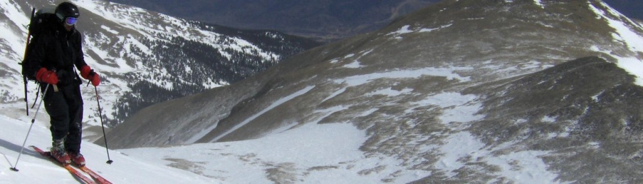
Colin and I decided to bring our avy gear and skis. Colin brought his microspikes but I left mine behind which turned out to be okay. I brought my Dakine Blade ski pack. I liked it better for ski carry and skin/avy gear storage than the Osprey pack I carried on Missouri and Challenger. I felt like the straps caused my thumbs to go numb but it did not seem to be the case on this trip.
We drove to the ranch North HQ building to meet the ranch hand Javier and sign in for the hike. Javier gave us bad and good news. The bad news was that no one had ridden a skidoo up the trail since the start of the winter and no one had been on the peak yet this winter so we would have to break all the trail ourselves. The good news was that he agreed to waive the 6PM return time rule because we had to break trail the whole way. He did mention that a mountain lion hunter had ridden an ATV a little way up the road a week ago but that (in retrospect) was absolutely no use to us. We got started skinning up the long road at 6:30AM. The temperature reading was 13F. This was identical to the trailhead temp on challenger point so I started with my marmot windshell, with vents opened, over my baselayer which worked well on that trip.
The Approach to the Ridge:
We stayed on the road as opposed to taking the hiking trail at the cutoff. The first ½ mile was not bad at all but the trailbreaking varied from ankle to knee deep after that. Where there were large animal trails on the road we followed them for the supportive base.

This was when we happened upon what seemed like fresh mountain lion tracks in the deep powder – guessing by the fact that the animal’s torso seemed to be dragging in the snow and we saw claw marks. The snow was too fresh and deep for us to be able to discern a clear pugmark.
We took turns breaking trail and got to four-way at about 10AM, much later than we’d hoped. We decided to stop there for some food. I have lately been bringing a couple egg and cheese sandwiches on these winter 14er hikes but Divi had made some lamb cutlets the day before that substituted the eggs deliciously and went well with my green tea.

We continued breaking trail above four-way…

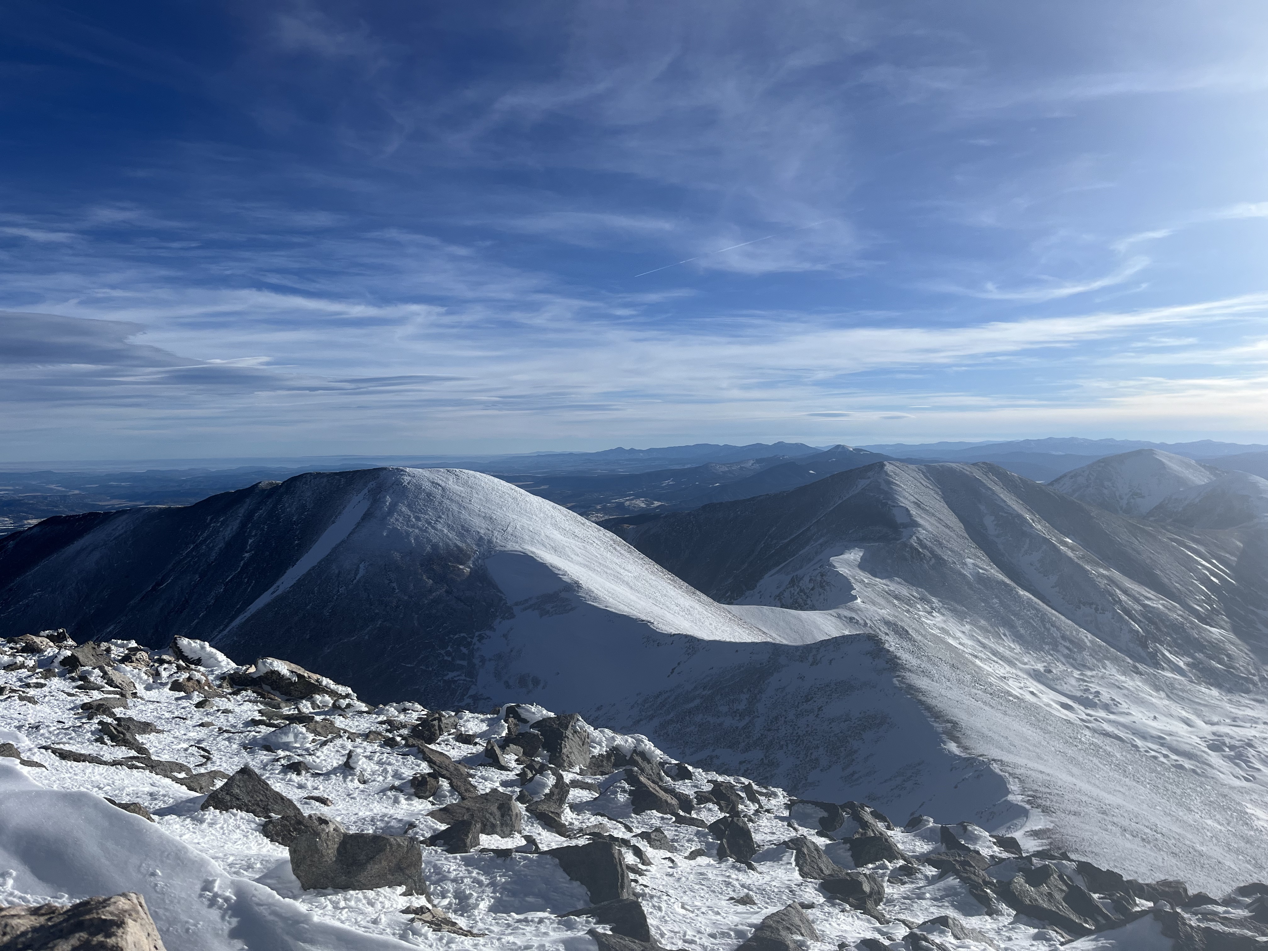
We passed the summer trailhead roughly after 11AM and began assessing the snowpack as we hiked past it toward the slope leading up to the ridge. We heard two or three whumpfs and saw some shooting cracks both on northerly and southerly aspects with the most stable snow appearing on aspects facing directly west.

We decided to stay as much as possible on those latter aspects, preferring lower angles ~20 degrees and areas with rock and grass sticking through. While this would later make for the worst skiing known to man, we felt safe with our chosen line. We turned our beacons on and gave each other some room when we traversed aspects that weren’t facing directly west.
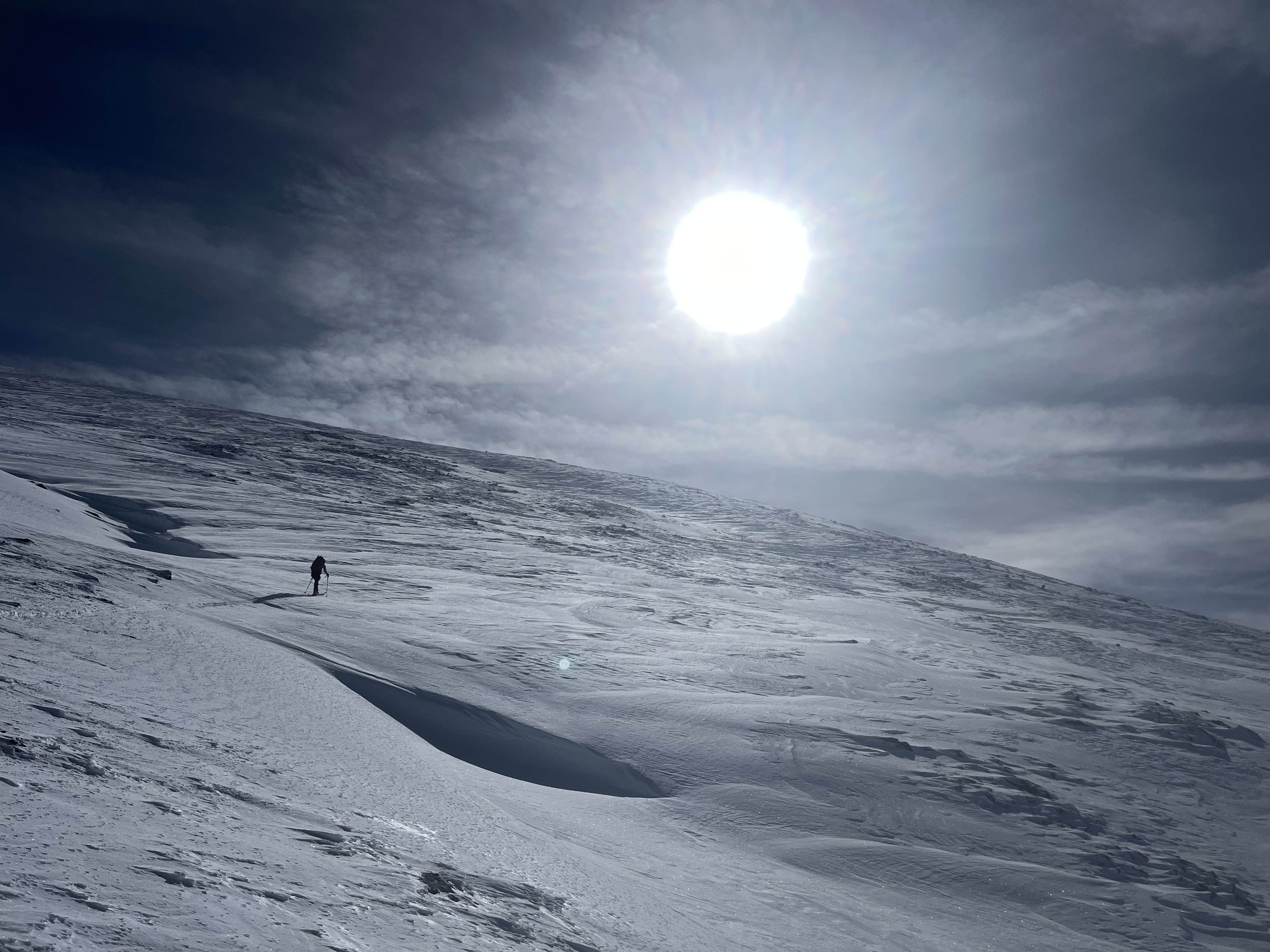
As we began topping out we saw some ~cm sized surface hoar feathers forming in little northwesterly facing pockets of the headwall. The commentary here (https://www.mtavalanche.com/blog/some-thoughts-surface-hoar) seems to suggest that buried surface hoar is closely aligned with human triggered avalanches when the burial isn’t quick and deep enough to cause natural avalanche activity, which seems reasonable in a range like the Sangres.

The Ridge and Summit:
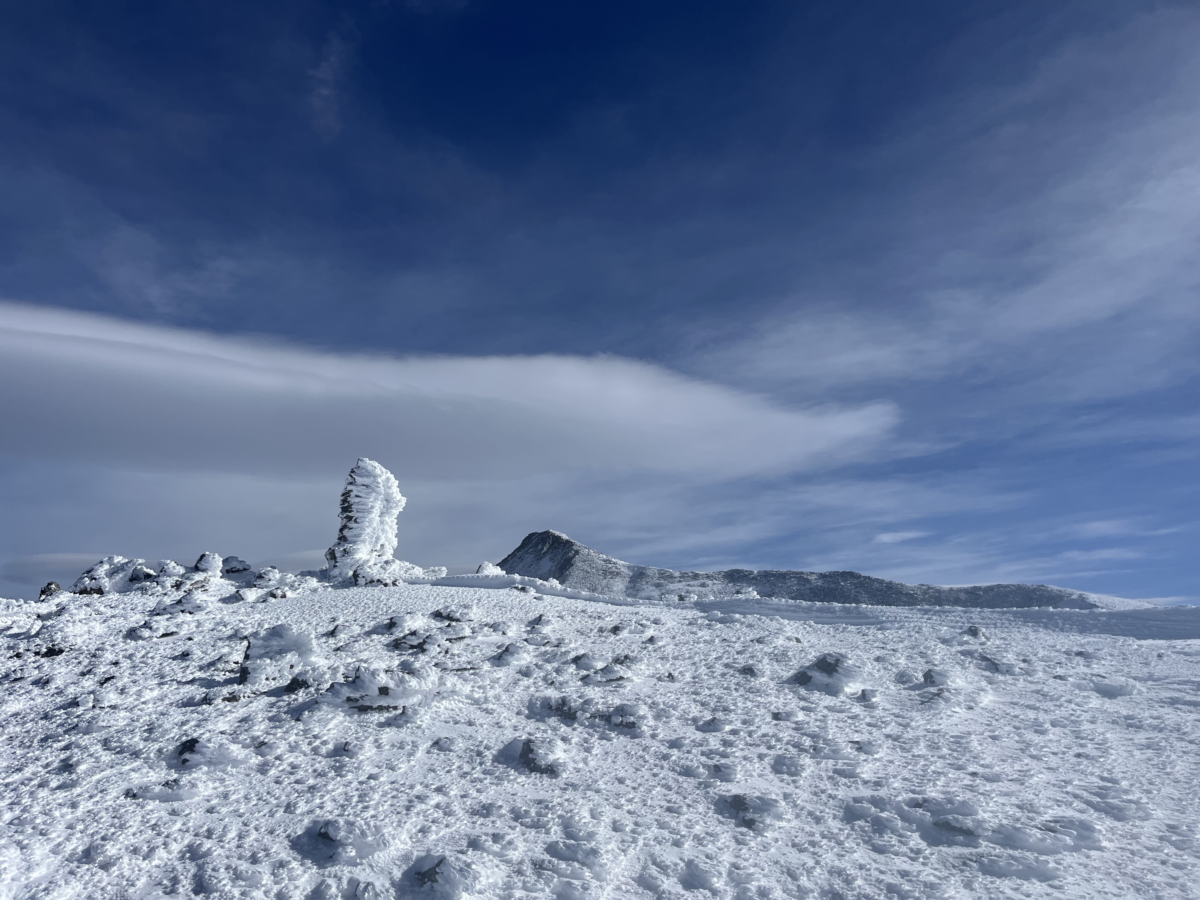
It was a late 1:45PM when we finally made it to the giant cairn marking the start of the ridge, roughly at about 13000’. It was plastered in rime –
We left the skis there and took the long walk to the summit in our ski boots. Colin had brought trail runners for the ridge but there was too much snow cover for them. He used microspikes for the ridge but I felt okay with the traction on my ski boots. The ridge was not as windy as I expected although there were some blasts from time to time. To pick up the pace we left our packs at 13300’ after eating some more food and drinking some fluids. We also put on our puffies before continuing further without packs.

After an endless number of false summits we finally sat on the summit at 3:30PM, 9 hours and 10 minutes after we left our cars.


The Descent:
We set a goal to finish descending the headwall and get back to the summer trailhead before dark and quickly began scrambling down the ridge without too much wasted time.

We made decent time getting back to our packs at 4:20PM. We ate a bit more food and I had more tea and then we quickly made our way back to the skis.

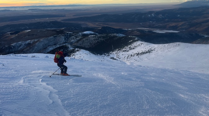
We got skins off, transitioned the boots/bindings and traversed to the top of the headwall by 5PM, ready to begin the ski descent.
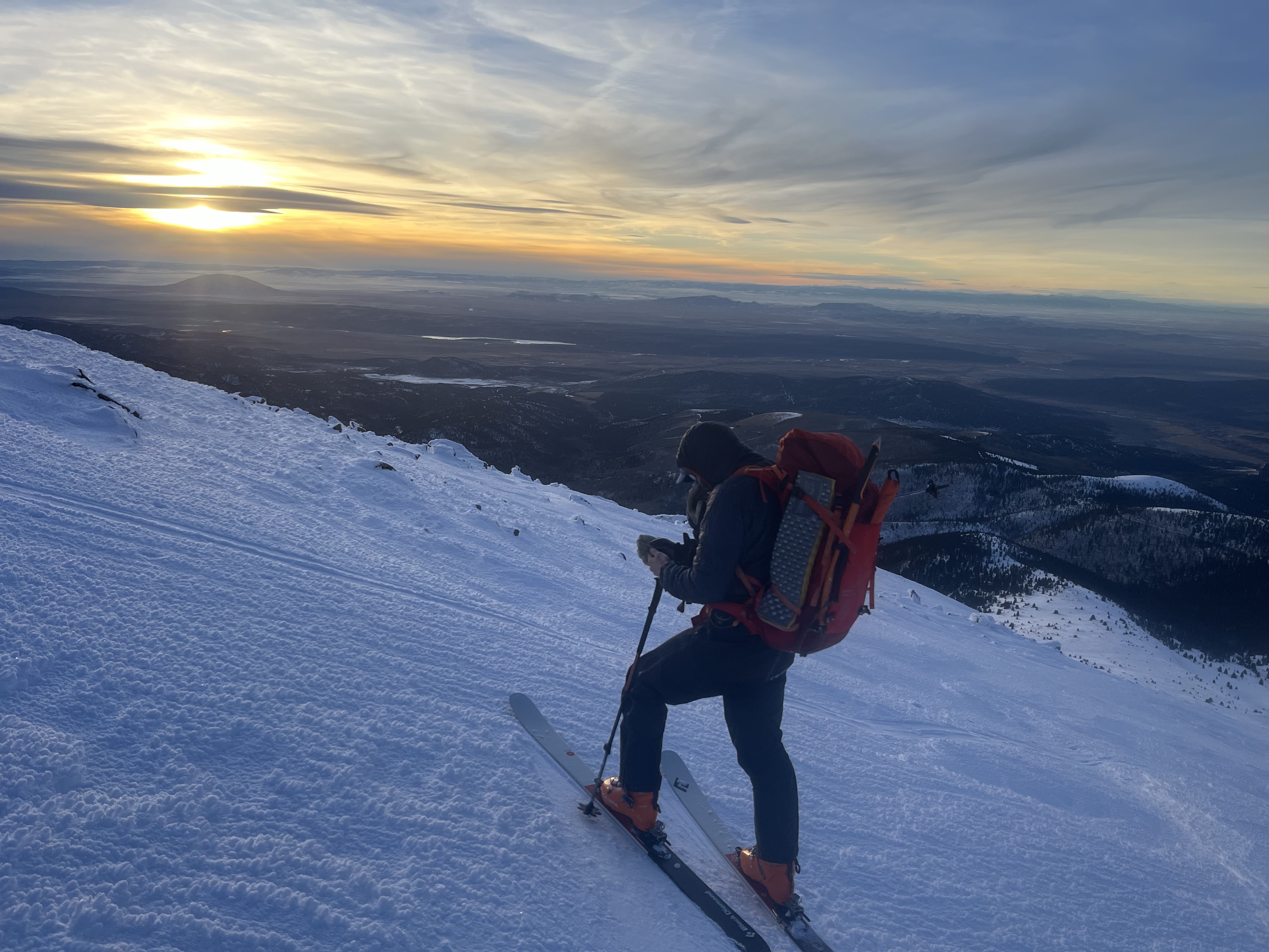

The sastrugi, trap crust and rock on the face made for a really challenging ski descent. There were a few comic spills, one of which dislodged my ski and had me plunge stepping about 50 feet to it. I also lodged my tips in trap crust at one point, flipped and landed on my head – oddly enough this improved the condition of my neck that was sprained from lying in bed the wrong way on a lazy day the prior weekend. Colin had similar comical encounters with sharks lurking below the crappy snow. We were fortunate to be down without injury and extremely glad we were able to finish that portion of the descent before dark. By about 5:20PM we were back at the summer trailhead which was great and the snow quality improved markedly at that point – at least it was consistently trap crust, instead of trap crust rapidly alternating with surface hoar, powder, sastrugi and wind-blasted ice all within seconds of each other. We got all the way back down to four-way before it got dark enough to pull out headlamps. I brought my mountain bike headlamp which attaches to my helmet and it worked great for the rest of the descent.
We hauled ass down the road as best as we could, to try and reach town before the two restaurants closed (at 8PM). Colin brutally disregarded the agonizing scraping of buried sharks against his skis. The ski down the road was mostly smooth sailing except for the partially buried rock and we made it back to the cars at 7:30PM. We raced our cars back to town, making it to the Thai restaurant right at 8PM. Colin did some begging at the door and our haggard, ravenous faces convinced good ol’ Ma Rios to reopen the kitchen for us. We each ordered an appetizer and two entrees and talked about the brutal day. Kiefer texted – he had bailed at 12000 feet on Blanca after the trail breaking had gotten too strenuous. I was grateful for being able to share that load with Colin making our own outing more successful.
The drive back home was tough and I had to pull over twice to nap but I made it back home and to bed at 3AM so I could get ready for Nila’s dance competitions on Saturday. Divi had done me a solid by hauling all of Nila’s gear out to the hotel in Denver where her competitions were occurring and I felt very fortunate to have had the opportunity to play hooky in the mountains while she was responsible.

