Route Stats and Prologue
Mountains: Mt. Huron (14,003’)
Route: Started at the winter road closure at 9080’ (3.1 miles below MO gulch TH) on county road 390 and climbed the NW slopes to summit.
Stats:
Elevation Gain – 5400’ (approx)
Roundtrip Mileage – 27 miles (16.2 from where plowing stops to/from Winfield, 10.75 miles RT from Winfield)
Crew: Colin and Prakash
Time to summit – ~10 hours, Descent ~5.5 hours
Colin and I discussed Huron a few weeks earlier trading texts back and forth about the gear we would use. We’d discussed with others and the 3 options were to (1) approach and descend on AT gear, (2) Boots for the road and snowshoes above the summer trailhead and (3) XC skis for the road and snowshoes above the summer trailhead. Colin didn’t have or use XC skis so that eliminated 3. We went back and forth on 1 vs. 2, leaning towards 2 given how much up and down I remembered there being on the road. I had the fortune of being down in Buena Vista with the family a couple nights prior and we did a family hike up 2.5 miles of the road which told me there was at least a 2.5-mile ski out without transitions and that by itself was enough for me to text Colin proposing skis but asking him to bring gear for both option 1 and 2 so we could make a gametime decision.
The last time I attempted Huron I attempted to drive the FJ up the road and made it to a mile below Missouri gulch trailhead, 2 miles from where the plow stopped its winter maintenance. In total my friend Joe and I spent 3 hours and a lot of energy digging ourselves and an RV and two other trucks that were blocking our entry / exit. Fantastic use of time. This time Colin and I agreed ahead of time that we would eat humble pie and park where the plowing stopped. We met at 2:50AM, briefly discussed gear, decided on skis and were on the trail at 3:20.
The Approach:
We made reasonably quick work of the road thanks to conversations of unusual depth. We were at the summer trailhead at 7:45AM where we took a break to eat and drop kids off. There was a faint snowshoe track a few storms old that set us a tenuous base albeit up and down and not very skinner friendly. There were a couple inches of snow on top of it.

Trail breaking up the drainage, aka the Wallow:
We followed the snowshoe trail for a couple hundred yards and decided it was more efficient to veer off and break our own ski trail up the drainage. Depending on aspect and shading the skis were sinking anywhere from a couple inches to a foot deep with skis.


In general, our west facing ascent aspect appeared wind featured and below the crust appeared uniform and consolidated (approximately following the NW slopes summer route here, adjusted to be avalanche safe – https://www.14ers.com/route.php?route=huro1).

That said we did still stay close to thicker trees and spaced out our traverses across more open areas and kept the avy beacons on.

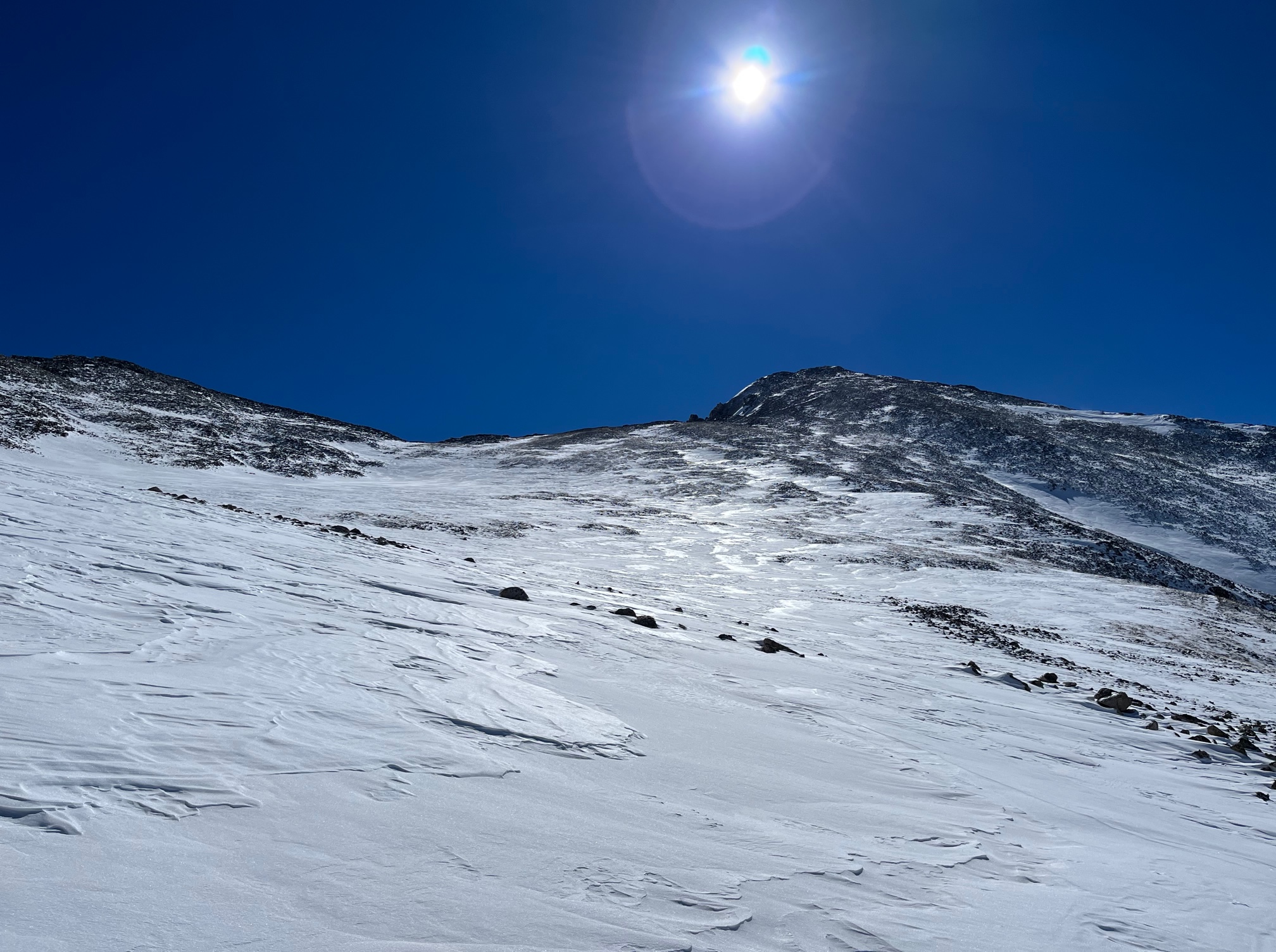
We broke out of the trees soon and stopped for breakfast and our first glimpse of the summit. It was a smidge past 10AM and appeared breezy on top.

It had taken 2:15 of hard work in the trees but we fancied our chances of standing on top and gave ourselves a target of 1PM to be on top.
The Climb and Summit:
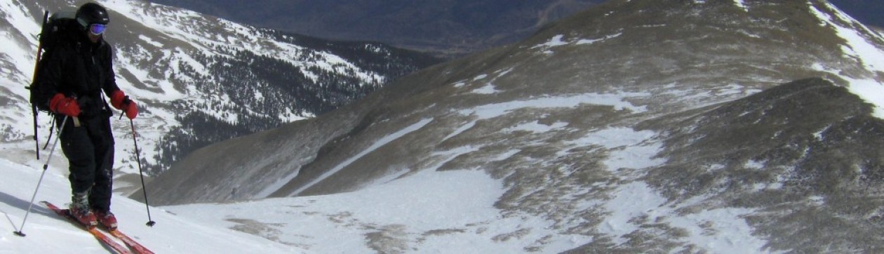
We took a wider path up the upper basin between Huron and Brown avoiding a steeper gully that the summer route appears to criss-cross. We also deviated from the summer route to find a path that would allow us to keep skinning.


We dropped our skis off within earshot of the summit banshees (13,500’ approx) and scrambled up the ridge from there. It was 11:45AM as we left the ski stash.
We stopped once again on the ridge to get facemasks on and eat some more food to cover the final push and a part of the descent. The summit area was breezy and we made our way up the path of least resistance. It was rather slow going but we finally topped out at 1:20PM – almost 10 hours to cover the ~13.5 miles to the top from the car.


We didn’t waste too much time since we realized we were up here quite a bit later than we’d hoped. I shot some texts off to Divya (since I had t-mobile reception there on the summit and nowhere else on the mountain, approach or even county road 390 for that matter) telling her we’d summited and to expect another text when I was back on US24, probably around 7PM.
The Descent:
We began hiking down the ridge quickly and got back to the skis and were ready to get going shortly after 2PM. The trap crust up high offered marginal skiing…

…but the skis were efficient and we descended the 2000 odd feet to treeline in half an hour, a third of the time it had taken to ascend that portion.

The heavy powder in the trees was much more fun for me on my new wider Black Crows setup than Colin’s skinnier all mountain setup but it went quickly regardless and we were back at the summer trailhead around 3PM.
Ski out:
The ski out was just as horrid as we’d imagined. Lots of up and down, transitions, skiing downhill with skins on because we were too lazy to transition, skiing uphill with skins off because we were too lazy to transition, etc. We finally reached the point where 2.5 miles were left at 6:30PM. This was where we would finally get a stretch of continuous downhill. We put our headlights on and skied it out in 15 minutes. 5:20 back to the car from summit over half of that spent on the flats from the summer trailhead. 15:5 hours in total. Lately I’ve managed to stay motivated on slogs like this only when there’s good company and there was plenty to be had from Colin. I tend to wuss out when I’m solo, preferring the comfort of a couch and warm food. Luckily, we managed to stick it out and it was worth it for the sense of accomplishment and my first new winter 14er (#37 / 53 ranked) after Nila was born. Two more Sawatch 14ers left to summit in the winter.
