
Route Stats and Prologue:
Mountains: Missouri Mountain (14,071’)
Route: Standard route variation meeting the NW ridge at 13650’, South of point 13695’. Started from Missouri Gulch TH.
Stats:
Elevation Gain – 5638’ (Garmin Fenix)
Roundtrip Mileage – 11.75 miles
Crew: Colin, Scot and Prakash
Time: 11:45 (8 hours to summit and 3:45 to descend)
Colin and I had the same two peaks left to finish climbing the Sawatch 14ers in Calendar Winter – Missouri and Holy Cross. We’d been saving Missouri for an early Winter weekend before the snows made the MO gulch trailhead inaccessible by car. The 22nd was such a weekend. The mountains had been relatively dry, and we’d heard good tidings on access from a friend who’d chained up and driven to Winfield, past Missouri gulch. I’d put on 10lbs vacationing in India the past month. I was at sea level most of the time, at a heat index of 100F. Those really showed on my training skin/ski in Steven’s gulch the previous weekend. All of that said, being able to shave off 6.2 miles RT by being able to drive WallE all the way to Missouri gulch felt like a huge bonus to me.
As we discussed logistics the prior Monday morning, I got news my hometown (Thoothukudi) was flooded in a once in a lifetime kind of rainstorm where they received 38” of rain in 24 hours. There was a foot of water (rising) on the main level of the house we grew up in. Power was out, people had gotten killed, and large roads and friends’ houses were washed away in runoff after a neighboring dam broke. We were very stressed my mother was by herself and that my brother was trying to get to her by road. He drove his 4 runner offroad and through moving 1.5-foot-deep water in the dark and got to her around 9PM Indian Standard time after driving 12 hours. Reunited with my mom in her hour of need my brother sent my sister and I this picture which provided me enough inspiration for a lifetime, or at least a few years –

The pictures my brother sent from our yard were very sobering –

… and what he had pulled off to get to our mom was not just heroic in our minds but also heart-warming! He had packed a birthday cake (amongst food, matches, candles and other supplies) and waded over a half mile through anywhere from knee to chest deep water to get to our house. Monday was our mom’s 77th birthday but they could only afford to burn one candle since they didn’t know when power and normalcy would return –

When the situation finally settled, I told my siblings that I needed to climb peaks in winter for a hobby because my regular life did not afford the kind of hardness it takes to just make a decent living in India!
Back to trip logistics, Colin and I quickly decided that snowshoes made most sense and Colin told me Scot was also interested in joining us which was a pleasant surprise. Scot subscribes to more normal mountain pleasures. The frozen 14er club (calendar winter 14er climbers) was the realm of the sub-human few that arguably need heads examined – probably around a dozen have finished all 58 of them in winter. Nevertheless Scot was great company, and it was great to have a third person to share trail-breaking duties… although, in retrospect don’t actually let the 6’5”, 255lb ex-NFL tight-end break trail for you unless you enjoy post-holing to your nuts (and sometimes chin) in snow. We made plans to meet at the Missouri Gulch trailhead on Friday 12/22, the first full day of calendar winter and we met at a dark and frosty 530AM.

The Approach:
We left the trailhead around 5:45AM. There was a surprisingly well-worn boot pack trail through the switchbacks that took us all the way to the log bridge and there the pleasant dream gently transitioned into the wallowing nightmare that we knew was coming. We donned snowshoes there and made it up the headwall to the old shack around 7:30AM. I took over trail breaking duties from Colin from the shack through the willows of Missouri gulch and we began to see signs of our objective.

We took the path of least resistance to the base of a low angle rib we planned to use to get up to the NW ridge. We took the Belford trail up as high as we could afford to before we cut across the creek bed, to minimize wallowing. That worked well.

The rib we chose to gain ridge access received sun earlier than the standard route and was less steep and showed more signs of rock and grass beneath which appeared safer to us from an avalanche perspective. Gaining the ridge so early did commit us to the path of gaining a few additional false summits (which eventually added 700 feet of elevation gain to our day) but it was a small price to pay for an avy-safe route.

We stashed our snowshoes at the base of the rib and put on microspikes. We never felt the need for crampons all day and even microspikes felt overkill in retrospect. The snow on our chosen rib was mostly knee deep and appeared consolidated to the ground below an inch thick surface crust. There didn’t seem to be enough volume and continuous snow cover for a slide although we all carried beacons, probes and shovels. The easterly exposure turned the face into a bit of a wallow in the mid-morning sun however.


Colin did a solid job breaking trail up to the ridge that we reached at approximately 13650 feet

The Ridge and Summit:
We reached the ridge at about 11:15AM and the wind really picked up and the windchill felt like it was barely negative. The point forecast for 13000’ had been 0 – 10F. We layered up for the ridge.

It was a long route to the summit from where we arrived on the ridge.

The ups and downs appeared relentless, and we mostly stayed either close to the ridge crest or skirting false summits on the west side. We finally reached the last section that offered a rocky ridge crest scramble vs. an exposed traverse along snow. We pulled out either axes or whippet in my case and chose the snow for most of that section.

We began arriving on summit between 1:15 and 1:30PM.

And grabbed some customary summit mugs – #38 in winter for me and probably pretty close for Colin as well.

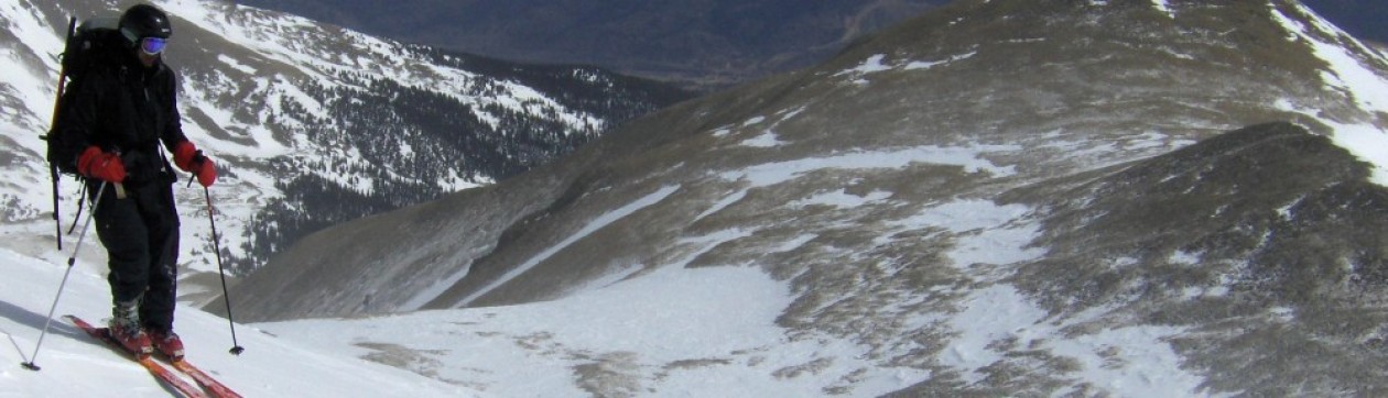
We looked down at our chosen line of ascent to the ridge.

The Descent:
We ate some food and decided not to waste much more time, beginning the descent around 1:45PM. My left thumb had gotten really numb from lost circulation and the cold despite the 10-hour handwarmers. I threw on my OR Alti Mitt shells which helped a lot on the descent. We quickly got past the fun exposed traverses on the west side of the ridge crest.

The descent went much faster overall, and we got back to our snowshoe stash, had a long break and were up and moving through the willows by 4PM.

The hike through the woods was uneventful and we just caught up on life and random topics on the walk back to the cars. The moon was out and I managed to get all the way back to WallE without needing to turn my headlamps on again.

#38 is done but it feels like a long way to go. With several harder more dangerous peaks left I feel a bit humbled that Missouri felt so rough. It was amazing to have the company of Colin and Scot on this trip! I much prefer that to those sometimes-necessary solo outings. We headed back to Leadville for some pizza and wings. We then drove back to Scot’s car at the park ‘n ride, staying awake discussing hilarious prior adventures in the mountains.
